New Release: Version 11

V11 has arrived
 

Built from your feedback. Focused on finding efficiency. 

RoadEng  & Terrain Tools Version 11 are inspired by real user feedback, and driven by a need to innovate an easier way to engineer. 


Terrain Module Feature Enhancements

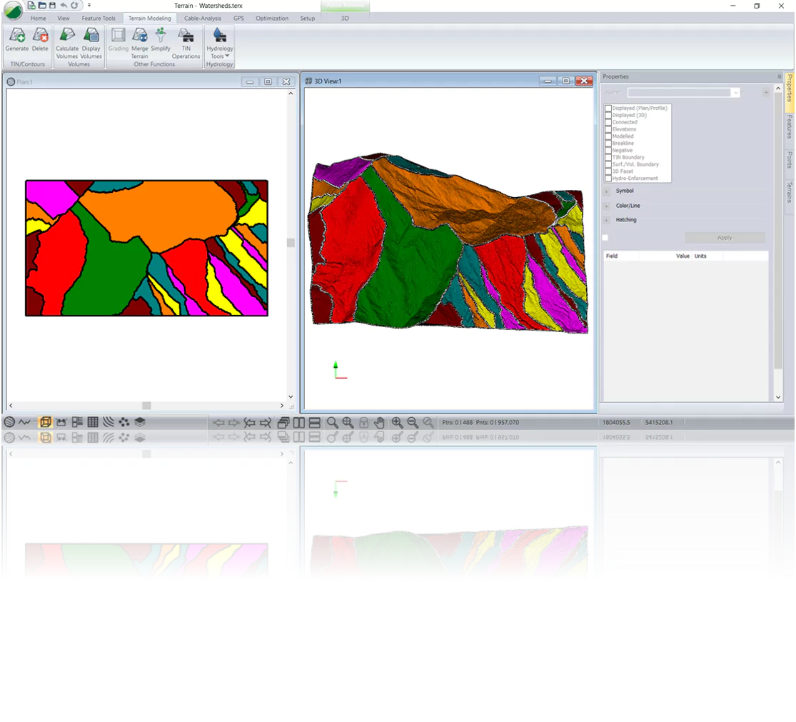
Watersheds​
Creates features for independent flow catchment areas of the TIN model. 

Watershed Calculation

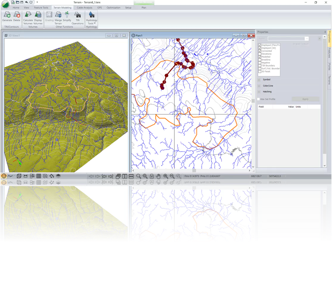
Streams & Ponds​
Expected location of streams in the TIN model, as well as locations where water would pool, represented as ponds. 

Streams and Pond Calculation | Terrain Modelling

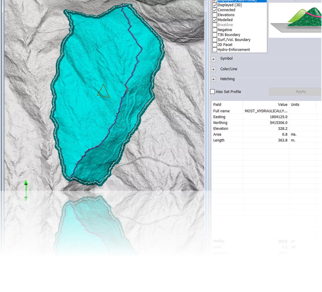
Drainage to a Point​
Calculates the area that drains towards each selected point or feature.​ ​Also calculates the Most Hydraulically Remote Flow Path & centroid.

Drainage Calculation | Terrain Modelling

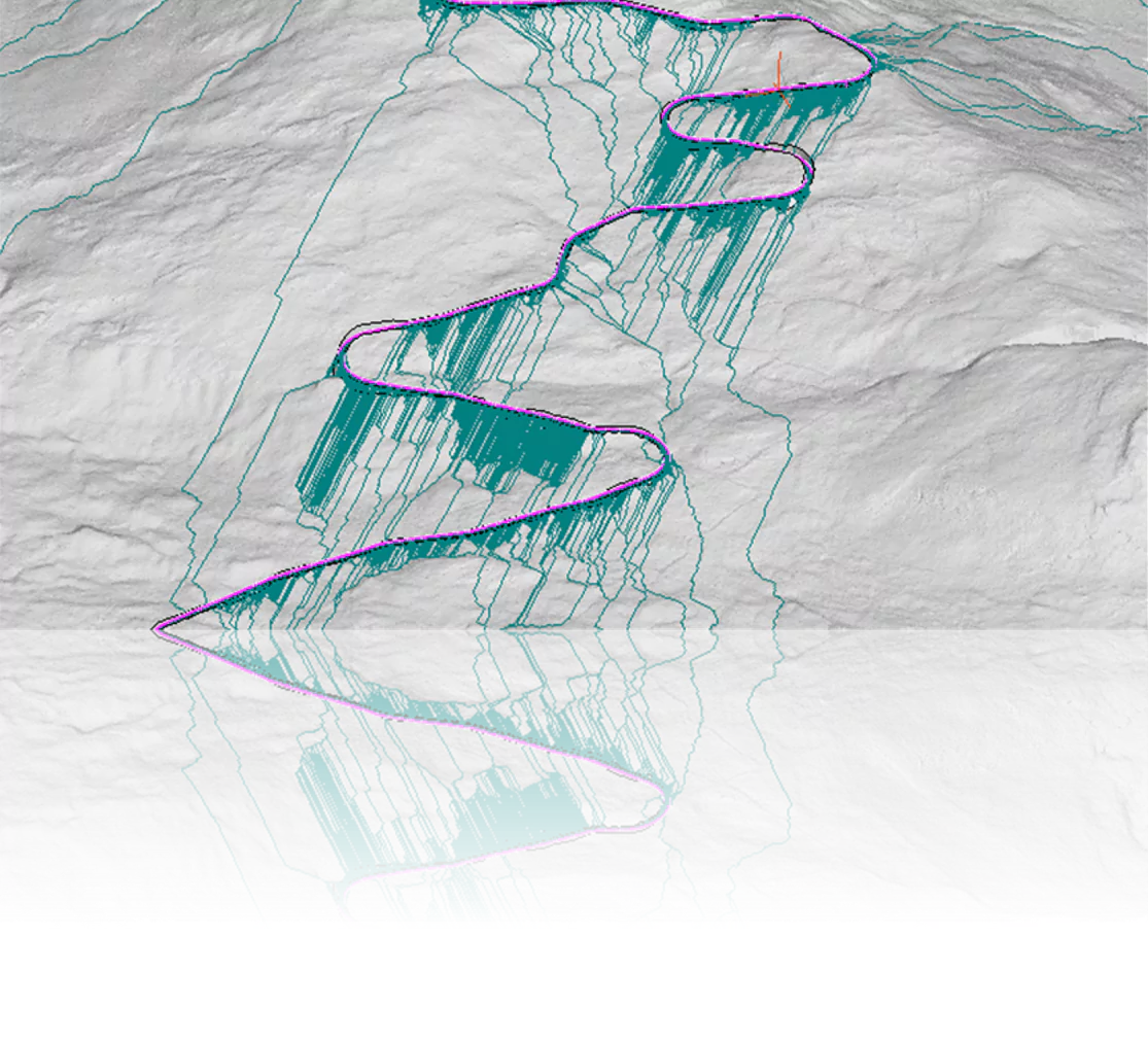
Flow Paths 
Calculates all flow paths from each selected point or feature. 


Flow Path Calculation from Points + Features | Terrain Modelling

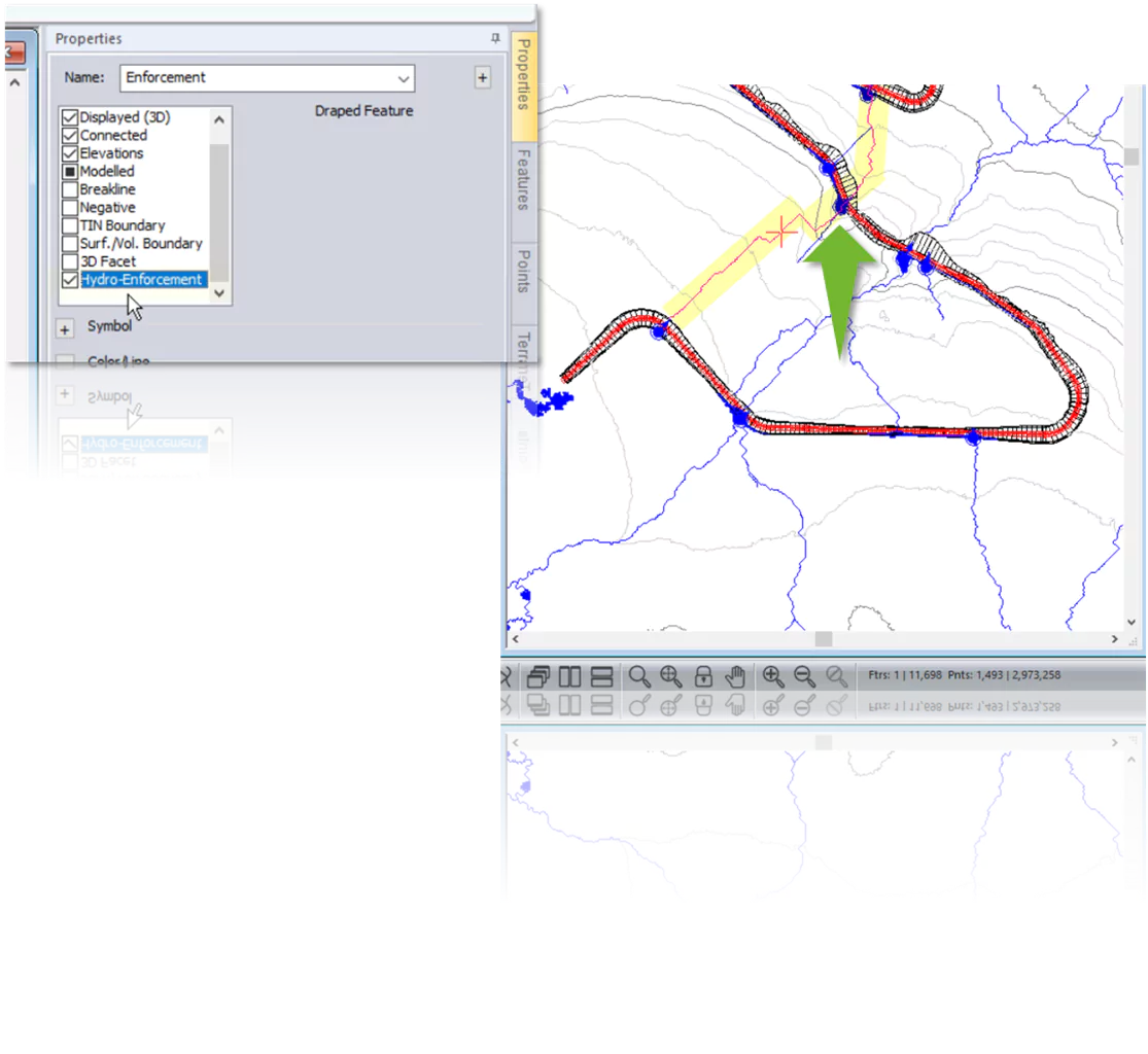
Hydro-Enforced Features
Allows flow through a feature rather than on the surface. Can be used in conjunction with other hydrology tools.

Hydro-Enforced Features | Hydrology Tools | Terrain Modelling

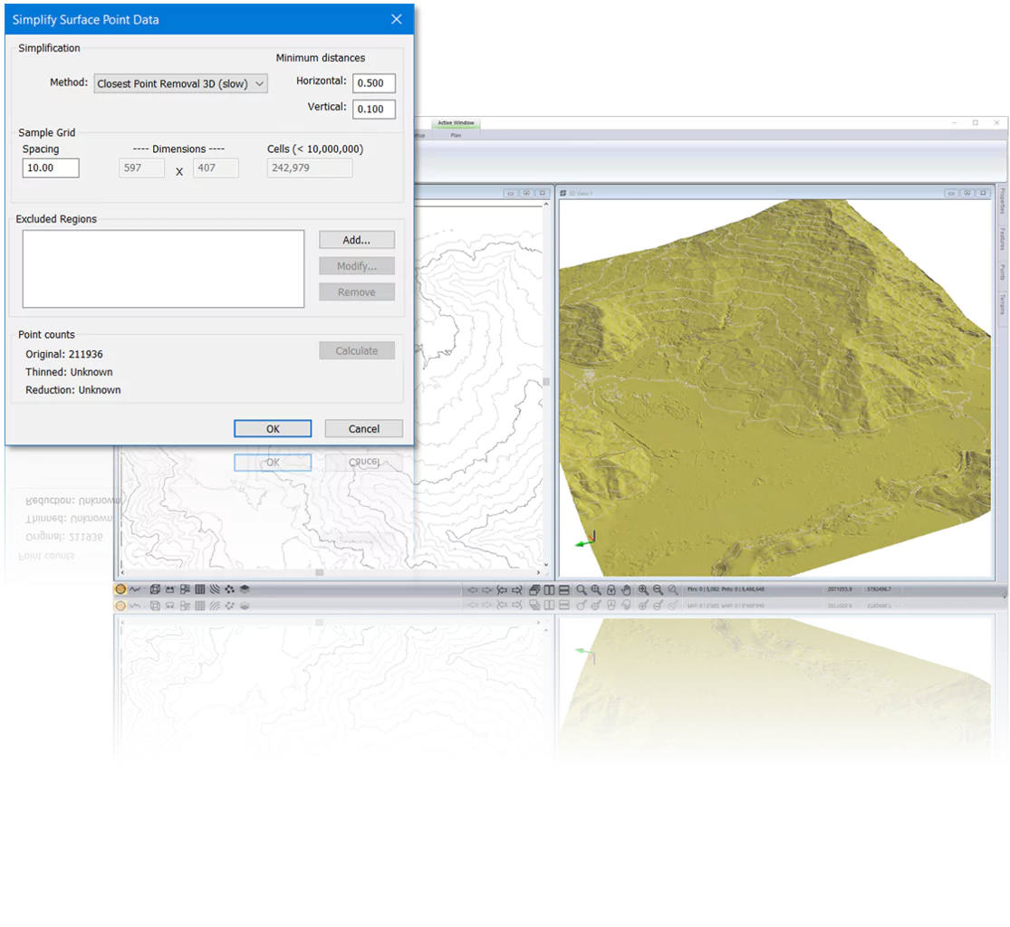
Thinning: Closest Point Removal (3D) 
Points close to other points (less than the minimum distance both horizontally and vertically), will be discarded. 

3d Modelling | Lidar | Point Thinning

Location Module Feature Enhancements

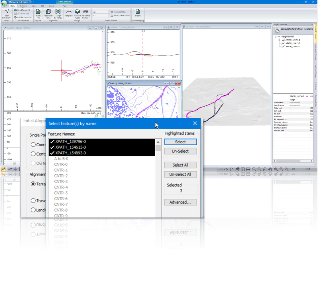
Polyline to Alignment:​ *Support-Exclusive Feature*
Generate an alignment with curves based on an input polyline. Applies to traverses,  Total Station centrelines, shapefiles & more!

Polyine to Alignment | Corridor Design | RoadEng

3D Corridor Surfaces ​
New Projects use default settings. Save and use custom settings in future.

3D Defaults | Corridor Surfaces | RoadEng

New alignments from multiple features​
If starting new alignments from a terrain features or Landxml, you can create several alignments at once.

Multiple Alignment Import | RoadEng

Multi-Plot: Multiple alignments in a book​
Create multi-plot books with more than one alignment. You can set each chapter with its own alignment.

Multi-Plot | V11 | RoadEng

Softree Optimal (add-on) Feature Enhancements

Smart Curves: ​
Vertical Curve Simplification Tool 
*Support-Exclusive Feature*
Simplifies vertical alignment through merging Curves and Vertical IP Reduction. 
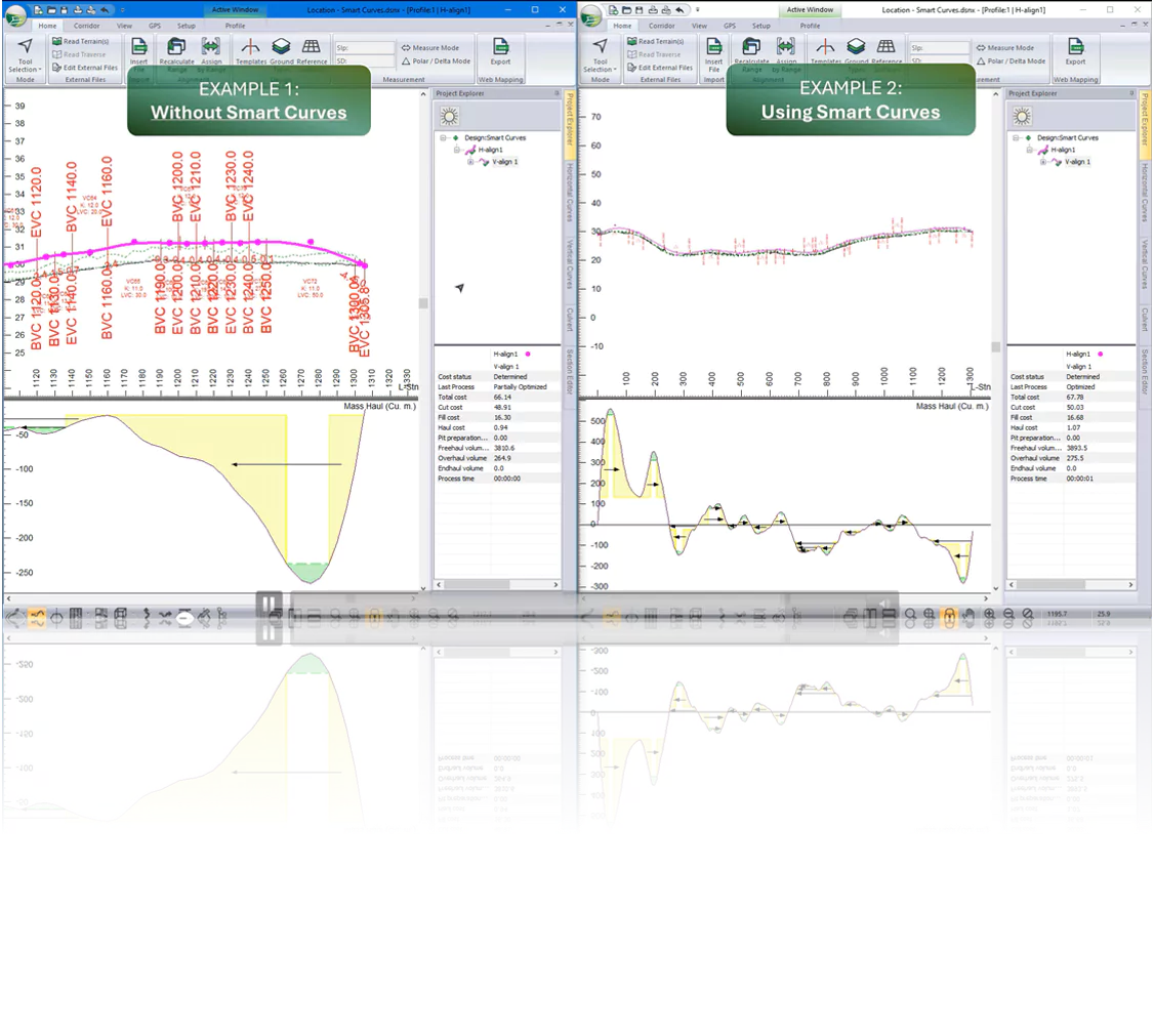
Smart Curves | Vertical Alignment Tool

Path Explorer AI *Support-Exclusive Feature*
Explore options to get from Point A to Point B in minutes. Path Explorer returns optimized alignment options within a matter of minutes.
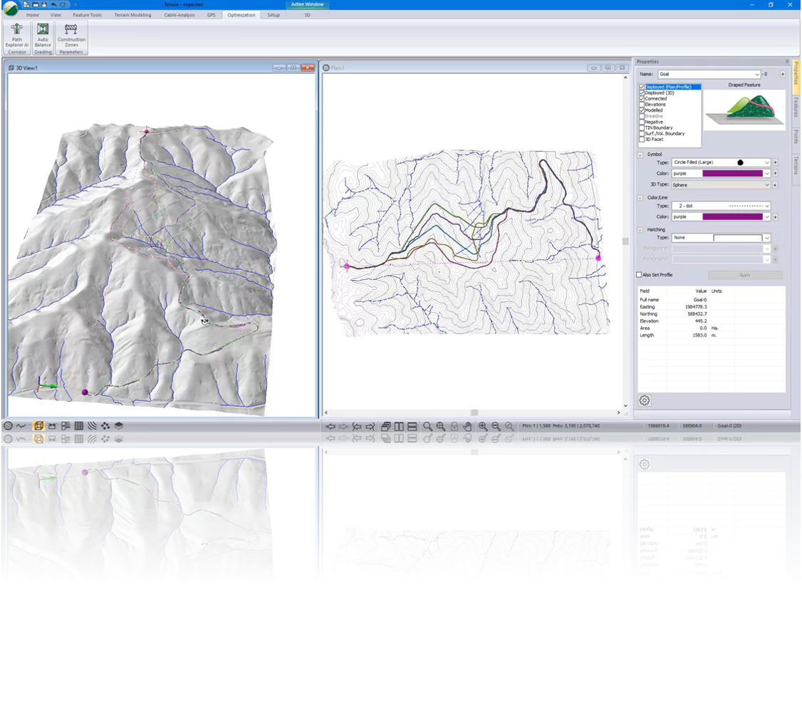
Path Explorer AI | Softree Optimal

Additional Screenshots (high-resolution):

Path Explorer - High Resolution Screen 1 (.png)

Path Explorer - High Resolution Screen 2 (.png)


+ Additional Functions

Terrain Module

  • New 3D symbols:
    • Stop Sign​
    • Yield Sign​
    • Transmission Tower​
    • Maple Tree​
    • Solar Panel​
    • Fence
  • Improved Panel Behaviour
  • Rasterize Function


Location Module

  • Corridor Function: break alignment
  • Corridor Function: Snap-to-alignment
  • Corridor Import - Naming perservation
  • Template Improvements & new templates
  • Save as Zipped RoadEng project
  • Paralellization of the cross section calculation
  • Multi-plot: RTF Rectangle
  • Mulit-plot: Scroll Icon
  • Multi-plot: Unicode support
  • Merging Terrain Surfaces into topo
Version 11 Webinars