Wind Farms & Renewable Energy

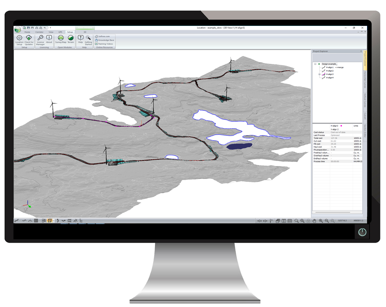
Wind Farm Access Roads and Pad Design
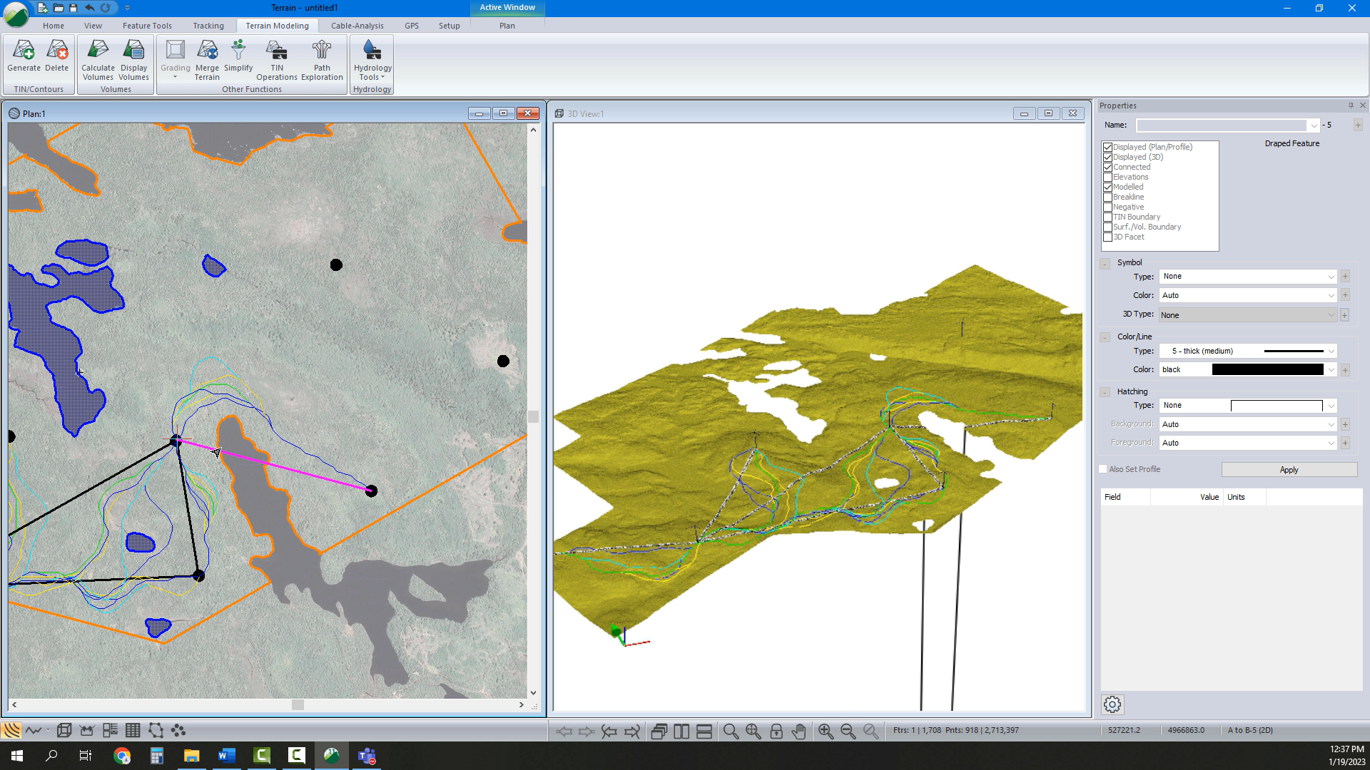
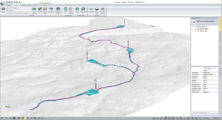
Our software gives you power to do more. An easier way.

RoadEng Civil Engineer with Softree Optimal allows you to design access roads, pad sites, and platforms (balance of plant). It allows you to perform a wide variety of engineering functions without a steep learning curve. Quickly create designs, optimize and calculate earthwork quantities, then easily export to machine control.

Request Pricing

Easier Access Road Design

Detailed geometric design for access roads in a fast, easier-to-use design environment. Get constant feedback from real-time window interactivity. 

User-friendly. Most users get up and running in an afternoon.  Learn the basics and start doing your own projects. 90% of our users do not require formal training.

Start with Your Survey Data

Workflows start by creating a Terrain model (TIN) from survey data. Work with large point sets including LiDAR data (up to 10,000,000 points), UAV, DEM, Total Station and more.

Customize your Terrain display options in 2D and 3D. Control contours, slope vectors, and color shading for slope, aspect, and elevation.

Pad & Platform Design

Crane pad and site design made easy with intuitive grading functions and site design tools, including the calculation of quantities.  

Costs & Earthwork Quantities

Get your earthwork and material volumes, as well as the sub-grade construction costs. We call this 'Design Time Costing'.

With earthwork costing data as you design, you can adjust your design based on cost. Compare costs for design alternatives. Know preliminary construction costs before you build.

Communicate Your Design

Easily share and communicate your design with Multi-Plot Report Builder. Creation of plan/profile sheets with automatic legends, title blocks, logos etc. Print out plan, profile, and cross-section data as one document. Simplify your presentation of deliverables with single document control.

Or export to a wide variety of industry standard formats, including LandXML, DWG/DGN and more!

Work with a Georeferenced Design

You can georeference your project data allowing you to work save directly as an Avenza Maps PDF file, export for construction staking or to export to Google Earth.

Direct GPS integration allows you to take your project out in the field, and view where you are in Plan, Profile, or Section view at any time. Create GPS tracks on your primary survey data.Make design changes on location.

Customized Cross-Section Template

Your cross-section template is an essential building block for your corridor design. RoadEng’s flexible template editor allows you to assemble typical sections using a library of customizable components.

Easily create a tailored template for your wind farm projects, including ditches (drains), cable trenches, sub-base materials, varying lane widths, cut slopes, variable height fill slopes,  etc.

Visualize the template in typical sections prior to implementing in your design.  Wind Farm Cross Section Customization Video 

Alignment Optimization

Use earthwork optimization to automatically find the lowest-cost vertical alignment design that satisfies your design constraints & standards. Vertical optimization on its own typically brings down construction costs by 10-30% or more, depending on the project, and saves a tremendous amount of design time.

Horizontally optimization works within a defined range of IP movement. Resulting improvements over 50% cost reduction are not uncommon.

Drainage Design

Add culverts along your road with the culvert editor panel. Modify culvert position, diameter, type, length, skew and gradient. Design options available for both natural stream crossings and cross drains.

Watershed analysis tools can determine watershed areas, drainage to a point, and identification of likely streams and pond features.

“McElhanney discovered “RoadEng” while looking for an easier way to deliver resource based road designs. Years ago, we tested the software with immediate success, going from watching training modules on the weekend to project delivery without delay in the following weeks.

Since that time, it has quickly become a companywide standard tool for the design of linear based projects including resource roads, construction access, pad design, pipelines, pedestrian trails, etc. We regularly us it to manage large LiDAR base plans, conceptual engineering, earthworks balance, and preparation of final drawings (plan-profile-cross sections-mass haul). We believe its greatest strengths are how easy it is to learn and fine-tune design alignments. The ability to have the plan, profile, cross section, and mass haul open at the same time provides a great visual aid for designers which leads to more effective designs. The addition of “Optimizer” provides valued engineering for large projects based on a wide range of criteria by automating the process. The Softree team is friendly and provides great support.”

-- Jason Paquette, AScT, Senior Technologist, McElhanney Consulting Services Ltd

Read More Testimonials