AI for Preliminary Road Design ​​​​

Path Explorer AI: Find your best road corridor in minutes

Path Explorer AI automatically finds feasible road and corridor locations between two points, optimized to minimize earthwork costs. In Version 12, Path Explorer AI Networks extends this to full road networks — optimizing routes between multiple endpoints across an entire project area. Generate alignment options in minutes using your LiDAR, UAV, or DEM terrain data, without manually testing dozens of routes.

  • Find optimized routes between A & B, or across a full multi-endpoint road network 
  • Minimizes earthwork and surfacing costs automatically
  • Meets constraints: max grade, side slope, max cut/fill, no-go zones, high-cost zones
  • Generates optimized alignment options in minutes
  • Works with LiDAR, UAV, DEM and conventional survey terrain data
  • Runs entirely locally — no cloud, no data sharing
New

Version 12 is now available — see what's new →
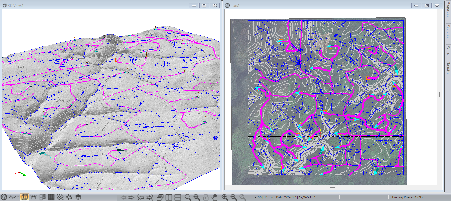
Path Explorer AI Networks — optimize entire road networks

Version 12 introduces AI Networks, which extends Path Explorer beyond a single A-to-B corridor to optimize routes between multiple endpoints across a full project area. Ideal for wind farm access road networks, forestry road systems, and any project where you need to plan connected infrastructure across large terrain. Define your endpoint locations, set your cost and constraint parameters, and let the optimizer find the best network layout — all in minutes.

Ideal for Greenfield Corridor Projects

Path Explorer AI is purpose-built for greenfield corridor projects using large terrain datasets — LiDAR, UAV, and DEM — and is equally suited to major realignments. Unlike GIS-based tools, Path Explorer works directly with TIN terrain models to generate true 3D alignments that account for real earthwork costs.

Control Path Explorer with Construction Zones

Define spatial costs and constraints using Construction Zone parameters. Supported zone types include no-go polygons, no-go polylines, cost polygons, and cost polylines. Common applications include wetlands, streams, environmentally sensitive areas, geotechnically unstable ground, and project right-of-way limits.

Road Design Ai - Wetland Example

Ideal for Preliminary Wind Farm Road Layout

Use turbine locations as your endpoints to quickly explore wind farm access road network layouts — especially powerful with the new AI Networks capability in V12. Path Explorer accounts for max grade, min cut/max fill limits, no-go zones, and crossing costs, giving you a solid starting point for wind farm road design in a fraction of the time.

Part of a Complete Road Design Workflow

Path Explorer AI is the ideal first step in a road design project. Once you've selected your preferred alignment, take it directly into RoadEng's Location Module to build a full geometric road design — no re-entry, no data conversion.

Support-exclusive feature: Path Explorer AI requires an active Softree support subscription to access. It is included with Softree Optimal licensing and requires RoadEng as the base platform.  Questions? Contact us or call 1-866-519-6222.