Civil Engineering Software for Mining

Haul and Access Road Design. Site Design. Stock Pile Volumes.

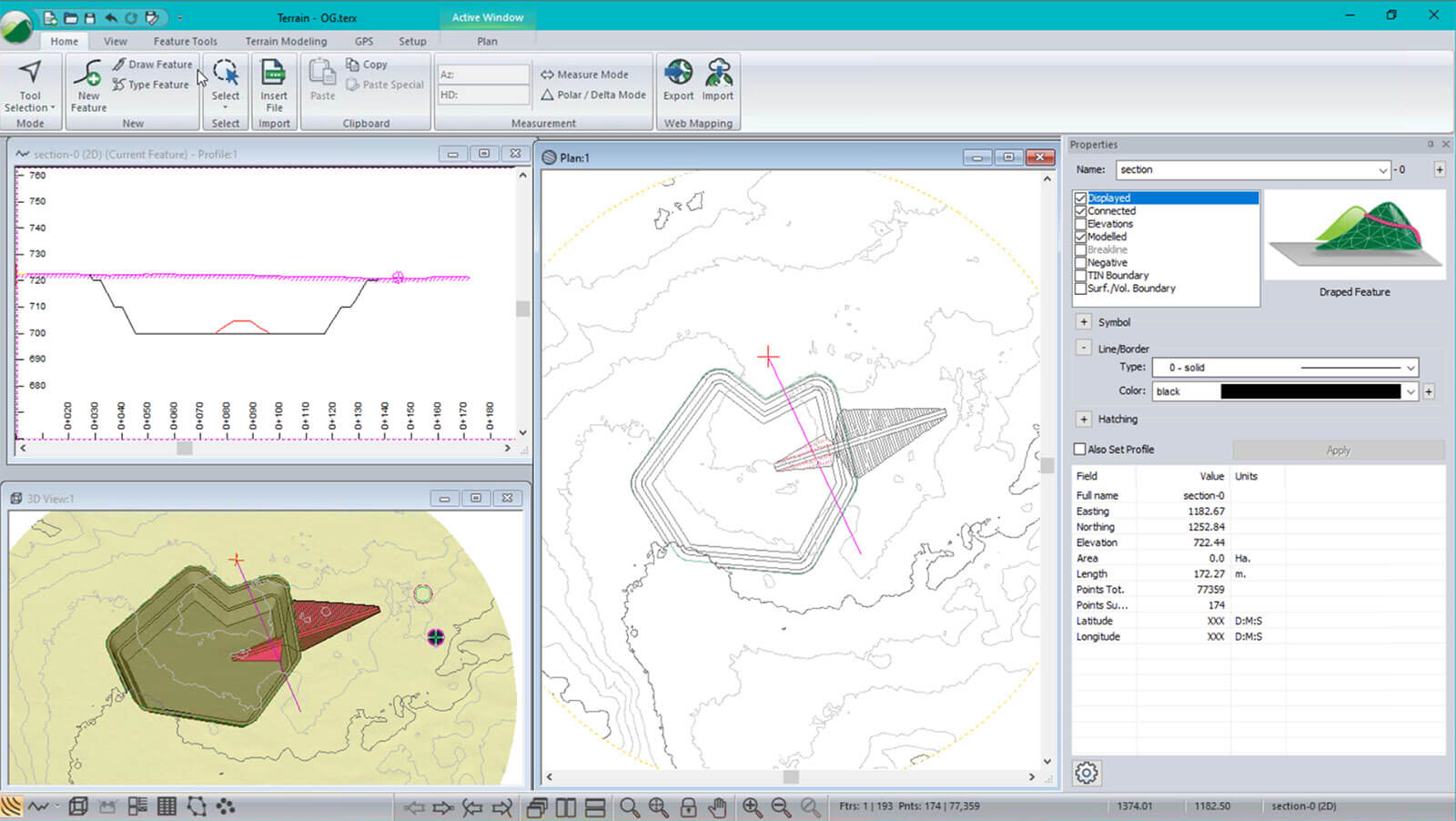
Stockpiles, quarries, open pit mine design, access, and haul roads an easier way. Softree develops software tools for 3D mapping, terrain modelling, grading, bench design, ramps, roads & more!

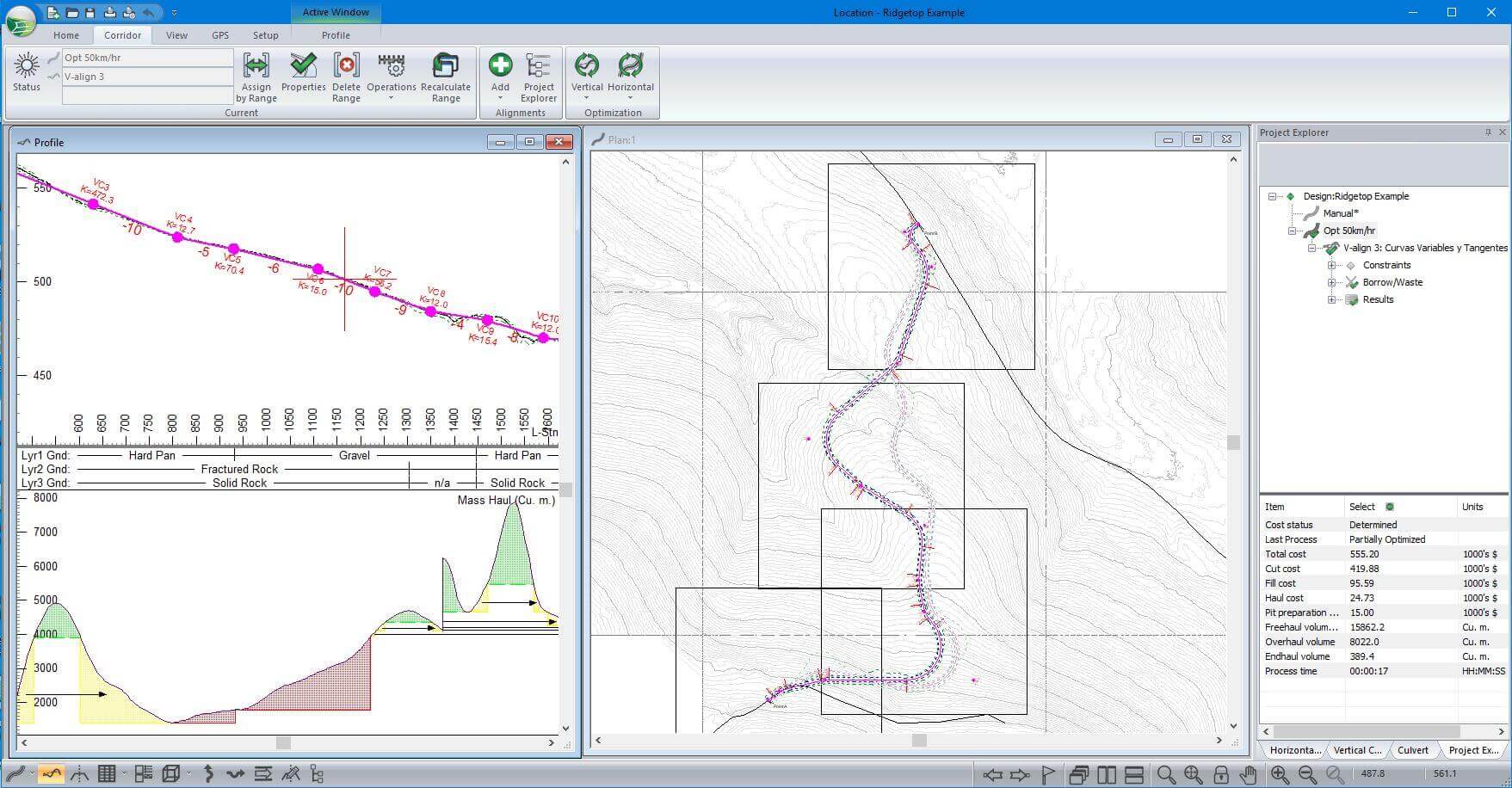
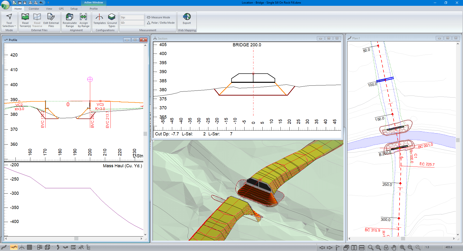
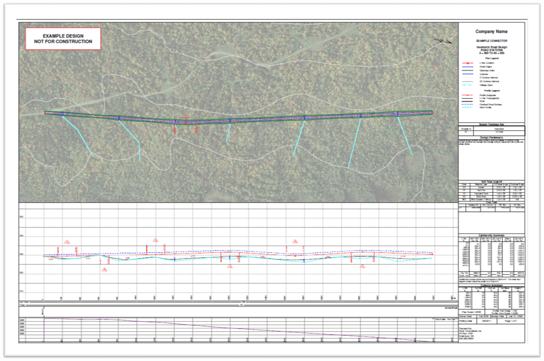
Access road and haul roads represent a significant cost to mining operations. With RoadEng and Softree Optimal, you can design lower cost roads by optimizing your earthworks and to reduce cycle times.

Powerful software tools for mine engineering:

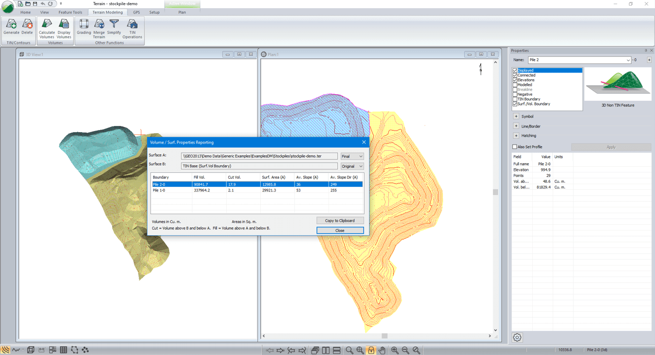
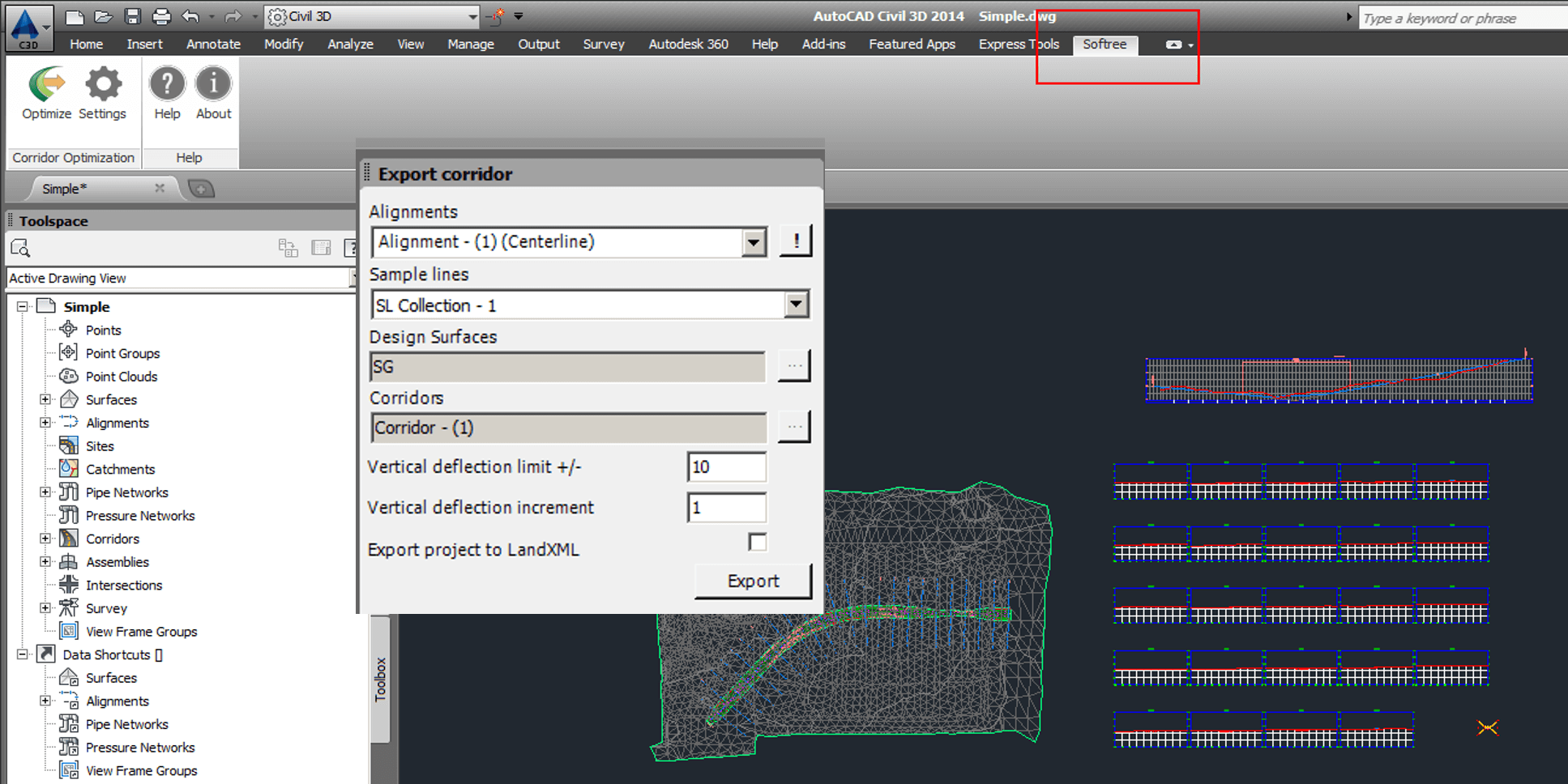
  • RoadEng Civil Engineer with Softree Optimal - ideal for road and site design, includes road earthwork optimization tools.  (includes functionality of Terrain Tools 3D)
  • Terrain Tools 3D - ideal for site design, stockpile volume calculations.
Haul Road & Mining Webinar

Interactive Haul & Access Road Design

Geometric design of ramps, access roads and haul roads with constant feedback from real-time window interactivity. A template editor allows you to easily create turnouts, widen curves, put in bridges, landings and cut benches.

mining_horizontal_optimization_1.jpeg

Haul Road Optimization

Engineer the lowest-cost haul road design that satisfies your design constraints & standards. Optimization technology automates the creation of your vertical alignment and offers improvement to your horizontal alignment's position. Bring down construction costs by 10-30% or more.(read more about Optimal here)

mining_horizontal_optimization.jpeg

Stock Pile Volume Calculations & Reporting

Calculate stockpile volumes using average end-area method. Easily calculate volumes between entire surfaces. Set a boundary feature and determine the polygon's surface properties (surface area, volume, average slope and aspect).

mining_stockpile_volume_calculation.png

Site Design of All Sorts.

A variety of simple but powerful features are available for site design and grading. Create virtually anything in 3D: terracing, pipes, surfaces, channels, ditches, pads or sub-surface zones.

bridge_site_design_2.png

Quarry Design

Create bench features with grade and offset functions. Select, edit, format and manipulate features. Move, scale, rotate, intersect, break, join and offset features. Control color, linetype, symbols, and hatching. Annotate distances, bearings, stations, and more.

pit_with_ramp.jpg

Survey Data Management

Automatically create a Terrain model (TIN) from large point sets, including LiDAR data with over 10,000,000 points. Customize your display options in 2D or 3D. See smoothed and labeled contours, slope vectors, and color shading for slope, aspect, and elevation.

Multi-Plot Report Builder

Easily share and showcase your design with Multi-Plot Report Builder. Print out plan, profile, and cross-section data as one document. Simplify your presentation of deliverables with single document control.

mining_output_sheets.png

Compatible Engineering Tool

Easily share DWG, DGN, and LandXML files with other programs. RoadEng works alone, or it can integrate into other CAD or GIS-based engineering systems.

mining_export_corridor.png

Product Options

RoadEng Civil Engineer

Complete road and site design software. Includes all the features: 3D Mapping, Site Planning, and Road Design. (*All the functionality of Terrain 3D is included with RoadEng)

Terrain Tools 3D

3D mapping and engineering. Easy, friendly, and inexpensive. Create 3D terrain models and engineering designs for a wide variety of mining-related projects.

“McElhanney discovered “RoadEng” while looking for an easier way to deliver resource based road designs. Years ago, we tested the software with immediate success, going from watching training modules on the weekend to project delivery without delay in the following weeks.

Since that time, it has quickly become a companywide standard tool for the design of linear based projects including resource roads, construction access, pad design, pipelines, pedestrian trails, etc. We regularly us it to manage large LiDAR base plans, conceptual engineering, earthworks balance, and preparation of final drawings (plan-profile-cross sections-mass haul). We believe its greatest strengths are how easy it is to learn and fine-tune design alignments. The ability to have the plan, profile, cross section, and mass haul open at the same time provides a great visual aid for designers which leads to more effective designs. The addition of “Optimizer” provides valued engineering for large projects based on a wide range of criteria by automating the process. The Softree team is friendly and provides great support.”

-- Jason Paquette, AScT, Senior Technologist, McElhanney Consulting Services Ltd

Read More Testimonials

Softree Mining Customers